Sand Mining and the Reshaping of Vietnam’s Rivers
River sand is widely used to build roads and homes, but removing it also changes the place it comes from. The sand forms part of the riverbed, influencing the channel through which water and sediment move. When it is extracted…
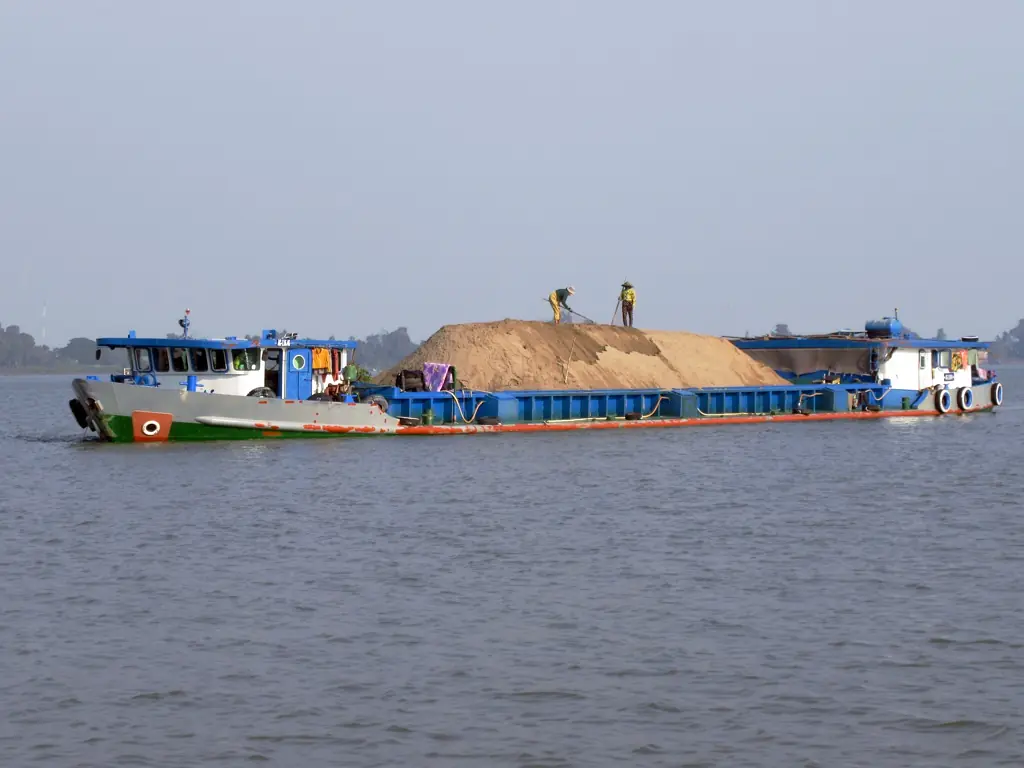 A sand barge near Tan Chau on the Mekong River, photographed in January 2025.
Credit: David Stanley / Wikimedia Commons, CC BY 4.0.
A sand barge near Tan Chau on the Mekong River, photographed in January 2025.
Credit: David Stanley / Wikimedia Commons, CC BY 4.0.

River sand is widely used to build roads and homes, but removing it also changes the place it comes from. The sand forms part of the riverbed, influencing the channel through which water and sediment move. When it is extracted, changes to the river’s shape can affect people living along its banks. [1]
Research published in Vietnam in 2025 examined how these changes develop beneath the water. Modeling on the Tien River, a main branch of the Mekong Delta, found that mining could increase erosion and that excavated areas could recover slowly. [2] The effects can continue after dredging has ended, leaving the river altered long after its sand has been taken to a construction site.
Vietnam’s River Sand Deficit
Sand moving downstream can replace some of the material removed from a riverbed. If mining repeatedly takes more than arrives, however, the river loses part of its stored sand and has less left to carry farther downstream.
The scale of that imbalance was established before 2025. A sand budget developed for the Vietnamese Mekong Delta in 2023 estimated that approximately 2–4 million cubic metres of sand entered the delta annually, while extraction removed about 35–55 million cubic metres a year. [3]
Although the estimates contain uncertainty, extraction is substantially greater than the incoming supply. Upstream reservoirs also trap sediment, reducing what can reach the delta. Mining then removes some of the material that is already in its channels. [3]
From Riverbed Excavation to Bank Erosion
As excavation lowers the riverbed, the underwater bank can become higher and steeper. This can make it unstable enough to collapse into the channel, extending the effects of mining to land used for houses, roads, or fields. Research on the lower Mekong has shown that excessive sand removal can lower the bed enough to cause this instability. [4]
The 2025 Tien River study examined the effects of 26 sand pits between Tan Chau and My Thuan. Its simulations produced maximum additional bed erosion of approximately 1.2 metres per year in two studied sections compared with scenarios without mining. That figure describes a modeled change in the riverbed; it does not mean the riverbank retreated by that distance, or that the whole river deepened at the same rate. [2]
The modeled recovery was not the same at every site. Some areas around Sa Dec approached their earlier condition, while others showed much less recovery. Stopping mining for a period may help, but it cannot be assumed to restore all excavated sections equally.
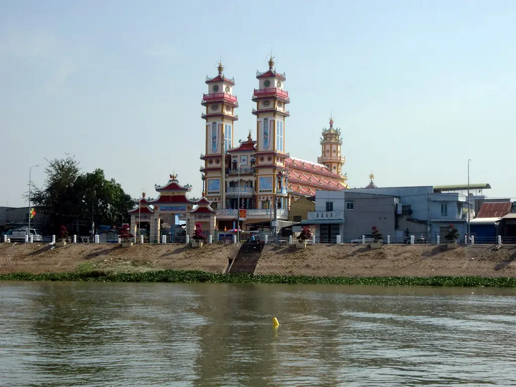 Tan Chau’s riverfront in January 2025. This photograph illustrates development beside the river; it does not document erosion at the pictured site.
Credit: David Stanley / Wikimedia Commons, CC BY 4.0.
Tan Chau’s riverfront in January 2025. This photograph illustrates development beside the river; it does not document erosion at the pictured site.
Credit: David Stanley / Wikimedia Commons, CC BY 4.0.

Changes in the Direction of Water
Deepening a riverbed can also change the routes water takes. In central Vietnam, the Quang Hue channel connects the Vu Gia and Thu Bon rivers. If that connection becomes deeper, more or less water may follow it, changing how water is shared across the river network.
A 2025 investigation combined field observations, analysis, and numerical modeling to examine this process. It linked the location of sand mining around the connecting channel, together with the riverbed’s slope, to increased erosion within Quang Hue and greater water transfer from the Vu Gia toward the Thu Bon. [5]
When more water moves into one river, the distribution of both water and sediment between the rivers changes. A mining permit assessed only within the boundaries of the excavation may miss these effects farther away. Studying the connected channels together can give a better understanding of what extraction means for the whole network.
Deeper Channels and Saltwater Intrusion
Near the sea, the depth of a channel influences how freshwater interacts with tides. In the Mekong Delta, deeper tidal channels can allow tides to travel more strongly inland and contribute to saltwater intrusion. These underwater changes can affect the freshwater used by farms and households.
Research published in 2019 connected stronger tides and increasing channel salinity with riverbed incision associated with reduced sediment supply from upstream and sand mining downstream. This helps explain why the erosion examined in later studies also matters for freshwater: a change in the channel’s shape can make it more vulnerable to saltwater. [6]
Freshwater flow and sea level also affect salinity, so sand mining cannot explain every period of saltwater intrusion. However, since deepening can intensify the problem, responses that consider water releases or sea-level rise also need to account for changes to the riverbed.
A Different Basis for Sand Management
A sand budget provides a way to compare material arriving in a river with existing stores, extraction, and losses downstream. Alongside assessments of bank stability and channel shape, it can help identify where further mining would increase an existing shortage of sediment. [3][4]
Checking actual activity is equally necessary. A separate 2025 study combined satellite imagery, automated boat detection, and river modeling to estimate mining activity and its effects on the Bassac, or Hau, River over 2014–2023. Its approach shows how independent observations can help assess extraction across a large area, providing evidence that can inform management decisions. [7]
Construction choices can reduce demand for newly extracted river sand. UNEP identifies crushed rock and recycled construction and demolition materials as possible substitutes, although each needs to be assessed for its intended use. Designing projects to require less material can also reduce pressure on rivers. [1]
Planning Vietnam’s roads and buildings involves deciding where their materials will come from and what extraction will leave behind. For river sand, that means considering whether the remaining bed can support stable banks and the continued movement of water downstream.
Sources
- Sand and Sustainability: 10 Strategic Recommendations to Avert a Crisis
- The impact of sand mining on the bed morphology of the Tien River, Mekong Delta, Vietnam
- The Viet Nam Mekong Delta Sand Budget
- River bank instability from unsustainable sand mining in the lower Mekong River
- Assessing the multidimensional impacts of riverbed sand mining on geomorphological change and water transfer rate: A comprehensive investigation of Central Vietnam’s Vu Gia Thu Bon River system
- Tidal amplification and salt intrusion in the Mekong Delta driven by anthropogenic sediment starvation
- Applying deep learning for boat detection and numerical modeling to assess sand mining impacts on river morphology: A case study in the Vietnamese Mekong Delta